Sunday, 26 October 2014

Plimsoll Line

When strolling up the Embankment in London on Thursday I walked past a statue I must have passed 10s of times.  But this time I actually stopped, looked at it and realised it was not a historical war figure (most of them are around there) but Samuel Plimsoll. creator of the Plimsoll line.
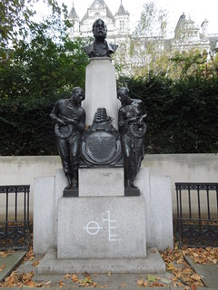
14 10 23 Plimsoll (2)
The Plimsoll line, the line indicating maximum load levels, has prevented needless deaths at sea from overloading.  It seems obvious now but in the 19th Century it took him over 5 years before it became law.  It wasn't helped that many parliamentarians at that time were ship owners and deemed his proposal as a profit curbing exercise.   You can read Plimsoll's breach of order in Parliament (otherwise known as a rant - for all the right reasons) in the 1875 Hansard.
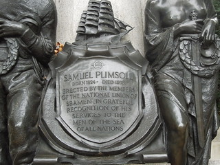
14 10 23 Plimsoll (1)
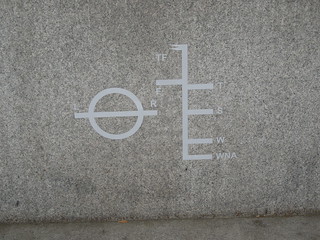
The symbols below are:

TF = Tropical Fresh
F = Fresh
T = Tropical Zone
S = Summer
W = Winter
WNA = Winter North Atlantic
and LR = Lloyds Register
14 10 23 Plimsoll (3)
The lines indicate the legal limit to which a vessel can be loaded for specific water types to safely maintain buoyancy.  Ships float lower in fresh rather than saline water so if they load to the fresh water line and then move into salt water with the same load, the sea level will align with the F and then the S as they float higher.  This classification obviously takes wave hazards into account which is why the least load is for Winter North Atlantic.  Mind you, I'd think Summer South Atlantic - Drakes Passage anyone? - would be pretty hairy.

Sunday, 28 September 2014

Mess Punkt

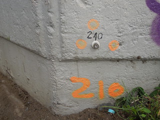
When in Cologne recently I continued my search of all things geo.  After my Amsterdam travels I knew what a benchmark should look like and, lo and behold, I soon found one.  For sure, most of them were not so elaborately marked, but there are oodles of them.
14 09 25 Cologne (1)
I also learnt a new word - Mess Punkt - a measuring point.  You can just about see the word 'Mess' on the plastic surrounding the small brass stud in the photo.  They also exist as small metal disks on the pavements.  Bizarrely I appear to have forgotten to photograph one.

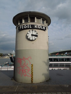
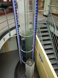
Of great excitement was the tidal tower by the River Rhine.  This initially looks to be a time piece, but the dial only goes up to 10.  Each tick represents a decimetre.  It is showing 3.3m here but the other side showed 3.0 a few minutes earlier and I can't imagine it goes up and down that quickly!
14 09 25 Cologne (12)
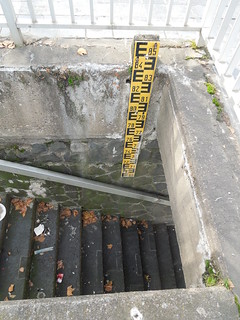
The average depth of the Rhine at Cologne is 3m.  Which, at it turned out, was what it was last Thursday.  This pole shows depths from 6.9m to 8.5m.
14 09 25 Cologne (9)
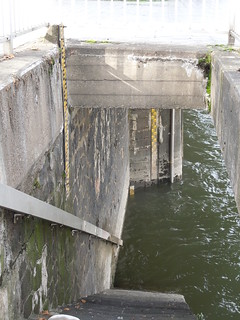
Looking further down the steps there are two more poles.  One from 6.9 to 3.2m, and, just peeping out of the water, is the 0 to 3.2m pole.  Tidal level 3.0m.
14 09 25 Cologne (11)
Low water levels obviously restrict the navigable channel, and docking opportunities for vessels with deep drafts.  At 2.5m depth it gives a 150m wide navigable channel (more info here).  However I suspect the more significant problem is the bridge clearances.  A 2.5m depth gives 9.1m clearance so some of the larger cruise ships appeared to have little spare.

Bearing in mind the Rhine here flooded to over 10m less than 10 years ago (which is 10cm short of the top of the yellow pole on the tide tower) you can see why the Cologne authorities have spent so much on flood protection.  

Sunday, 21 September 2014

Rocky Benchmarks

Some friends of mine have just been to Colorado for some walking in the Rockies.  They sent me a photo of an unusual find they came across whilst on their hike.
14 09 Lora Colorado
Not quite what one would expect 14 000 feet up but perhaps it was next on the cabin's occupant's 'to do' list.

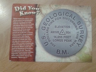
A week or so later this postcard arrived in the post.
14 09 17 Postcard BM
This has to rate as the coolest card I have ever received.  And probably only appreciated by those with supreme geodetic good taste ;-)

Tuesday, 19 August 2014

Normaal Amsterdams Peil - Amsterdam Ordnance Datum

During a recent visit to Amsterdam I was able to discover more about the Dutch vertical datum; from its humble beginnings in the 17th Century through to being the origin point of the European levelling network.

NAP, Normaal Amsterdams Peil, approximates to MSL, Mean Sea Level.  However its origins date to the Amsterdam Peil (Amsterdam Level) which was based on the mean level of the IJ, the main waterway of Amsterdam.

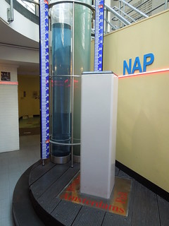
There is an informative visitor's centre in the City Hall which you can visit for the grand sum of 1 Euro.  As NAP is lower than the ground floor, the exhibition is in the basement. The top of the brass mound sitting on the white pillar is zero.
14 08 14 NAP (7)
And the water levels indicate the current height of the canals.
14 08 14 NAP (2)
The exhibition covers the history of vertical datums in the Netherlands.  It included a display of tide poles, which I forgot to photograph, showing how each region initially had its own vertical datum.  This was a very common phenomena 350 years ago and  improved over the centuries as geodetic networks increased their geographic reach.

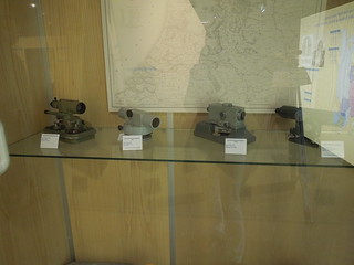
The display of levels below took me back.  I remember many hours of levelling the campus at Newcastle University...  I left the exhibition knowing that my Euro had been well spent.
14 08 14 NAP (5)
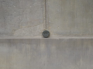
I then set off to find the only surviving marker stone of the level of the sea dyke in the 17th Century.  But on my way I discovered my first ever Dutch benchmark in Dam Square. The NAP exhibition had a display of these so I knew what to look for.
14 08 14 NAP (8)
There are apparently 50,000 of these in the Netherlands.  So that's only 49,999 to go.

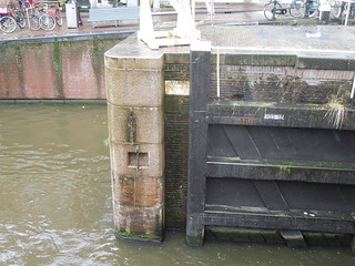
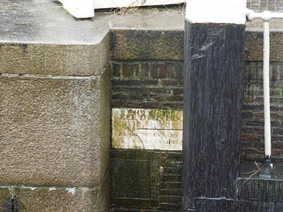
In the pouring rain I then walked to Eenhoornsluis, Unicorn Sluice, Korte Prinsengracht. This level marked the mean high tide during the summer - the height of the sea dyke.  For more details there is a good paper here.
14 08 14 NAP (10)
The inscription reads "Sea dyke's height, being nine feet and five inches above City Datum". What an absolute treat to find.
14 08 14 NAP (9)

Wednesday, 6 August 2014

Arran - 6 Trigs and a Lighthouse

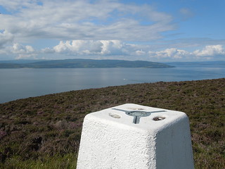
What a great week on Arran!  Not only did I manage to bag six trigs in five days, but I managed to do this in a mix of weather states.  The weather forecasts were sublime.  I'm pretty sure they predicted the same thing each day "sunny intervals with scattered showers" so some days we had glorious sunshine and got burnt, and other days we shivered in our waterproofs.  It wasn't even height related - our highest trig, 874m, was admittedly the wettest bag but on subsequent days (forecast "sunny intervals with scattered showers") it was perfectly clear at that height with the cloud base somewhere near the International Space Station.

Our cottage was in Lamlash and, joy of extreme joys, I could actually see the trig on Holy Island opposite without having to leave the lounge.

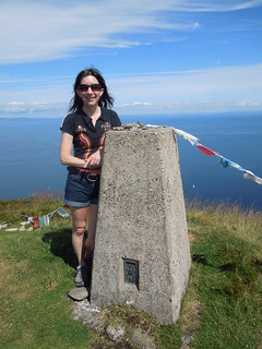
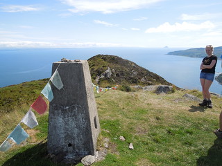
So the first trig was TP3987, Holy Island.  A wonderfully hot day which rendered this a shorts and tshirt trig.  Not to mention Budhist prayer flags to add a bit of flair.
14 07 28 Holy Island Arran (28)
It was clear enough to see the Ailsa Craig.
 14 07 28 Holy Island Arran (34)
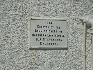
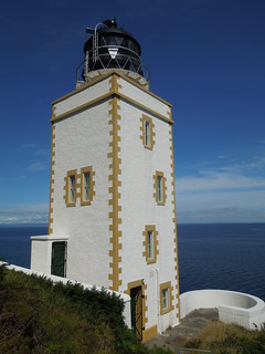
On the way back down we detoured around the south east of Holy Island to view one of Stevenson's latest lighthouses, and the first square one constructed.
14 07 28 Holy Island Arran (37)
14 07 28 Holy Island Arran (39)
A well maintained lighthouse.
14 07 28 Holy Island Arran (41)
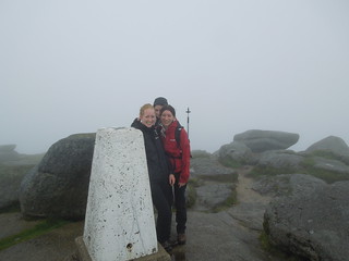
The next day we tackled the highest point on Arran, Goat Fell.  TP3393, Goat Fell, stands at 874m and it's an easy climb up from sea level.  It was pretty cold and blustery at the top as we shivered in the clouds.  We didn't hang around for long.
14 07 29 Goat Fell (3)
On Wednesday I decided we could bag a trig on the way to see the Machrie standing stones.   We parked on the delightfully named String Road, and literally hoicked straight up the ridge. It amazes me that one encounters bogs even at the tops of hills, as we did with this one.  Living near Dartmoor, this shouldn't surprise me at all.

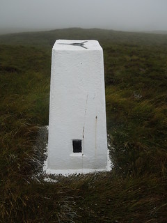
We had noticed the day before that the Goat Fell trig had had a recent coat of paint and wondered if there was a trig pillar maintenance army on Arran.  On arriving at TP0848 An Tunna we were convinced.  Not only had this trig been recently painted, but the grass was still white.
14 07 30 2 TP0848 An Tunna (2)
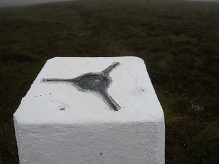
There is so much white gloss being used that it has filled in the hollows underneath the metal hoops used for lashing one's theodolite to the tribrach.
14 07 30 2 TP0848 An Tunna (3)
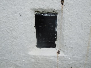
And I am certainly not impressed with the black gloss paint over what would have normally been a beautifully weathered brass flush bracket.  Whah :-(
14 07 30 2 TP0848 An Tunna (4)
Anyway, not enough to upset me for long.
14 07 30 2 TP0848 An Tunna (6)
After some standing stone bagging - I wonder if these were prehistoric prototypes of a trig pillar - I realised that our route home took us right next to a drive-by trig.

TP1322, Bennan, is such a trig.  Minimal exertion needed.  It is a drive up a small track and it stands next to a small reservoir.  As expected, this had also met the same fate as the previous white trig.
14 07 30 4 TP 1322 (6)
Now admit it: a trig in the sun with a view is a truly beautiful thing eh?
14 07 30 4 TP 1322 (2)
Thursday's trig was found on the way to see the King's Caves on the west coast of Arran.  This took a couple of goes to reach as our initial approach was via a fern covered slope.  Now I can do ferns...but not when they are taller than me.  So we approached via a forest (and a bit of fence hopping), to find TP6539, Torr Righ Mor.
14 07 31 TP6539 (6)
View across to the Mull of Kintyre.
14 07 31 TP6539 (4)
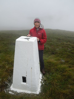
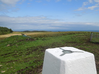
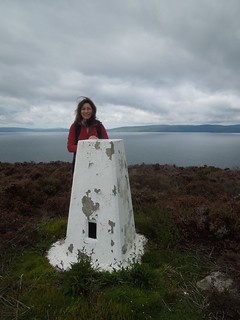
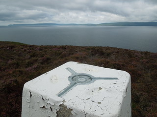
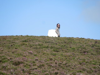
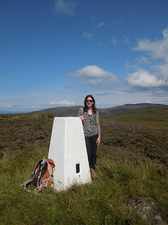
My last trig was on the Friday after a visit to the Arran Distillery in the north of the island.  Again, an easy find as you simply park up at the village of Catacol and climb up.  When you run out of hill to climb you know you're there.  And there is even something to lean on whilst you await the arrival of your photographer...
14 08 31 TP2046 - Catacol (1)
TP2046, Catacol.
14 08 31 TP2046 - Catacol (5)
14 08 31 TP2046 - Catacol (6)
I never did make it to my planned 7th trig.  On Saturday the forecast weather (sunny intervals with showers) turned out to be pretty wet, as in constant heavy rain.  And although I'm waterproof and don't mind a bit of precipitation, lack of waterproof trousers put me off and the tea shop called instead.  And, anyway, best leave some for my next visit eh?

Thursday, 24 July 2014

Second Time Lucky - A Lovely Scottish Binman

Last September I visited Glasgow and was thwarted in my attempt to find some geo goodies in George's Square due to construction work.  So today, up with my family for the Commonwealth Games, I had another go.

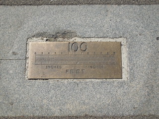
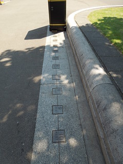
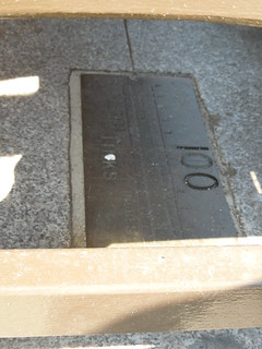
I found the 100 foot marker easily.
14 07 24 Glasgow St Georges Square (2)
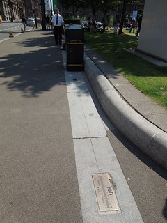
But was a tad disappointed that they'd plopped a bin on top of whole 100 foot stretch.
14 07 24 Glasgow St Georges Square (3)
A chap kindly moved for me so I could photograph the first 10 feet.
14 07 24 Glasgow St Georges Square (4)
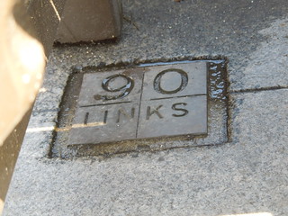
I mentioned to him what I was photographing and he mentioned that there was another set of markers the other side of the grass. This turned out to be a 100 link stretch. But unlike the 100 foot markers which simply had a bin and a (mobile) person on it, this set had a whole Scottish tourist board of benches over it. So I did what any surveyor would do and dip and dive between tourist legs to photograph the brass plaques under them.
14 07 24 Glasgow St Georges Square (5)
14 07 24 Glasgow St Georges Square (6)
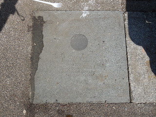
I was enormously suffered by the bench sitters who allowed me to stare under them. My family disowned me and watched the pipers - which is what every other sensible person was doing to be frank. However I wasn't happy as I couldn't find the RICS plaque. So I sat and downloaded the Glasgow Geek Guide to find out exactly where it was. It was at the beginning of the 100 link stretch. Which was precisely where a bin was.

As luck would have it the bin was just being emptied so I sauntered up to the binman. "Hi," I smiled, "I think there is a plaque under your bin I'd like to see". "I don't think so love," he responded. I persisted, "Can you please humour me a minute and just lift it? I really think there is something under there that is related to these brass markers." And I explained the relationship between the brass link pointers and zero. Anyway, I won him over and he lifted the bin. And lo and behold there it was!
14 07 24 Glasgow St Georges Square (8)
It is quite hard to read but it states "To mark its centenary year in 1997. The Royal Institution of Chartered Surveyors in Scotland has provided finance to assist in the maintenance of this standard chain."

So I'd like to dedicate this blog to the lovely Scottish binman who humoured an English woman and lifted a bin. He got a hug.
14 07 24 Glasgow St Georges Square (1)


Wednesday, 2 July 2014

Military Map

On Monday I was privileged to visit the Queen's Gallery.  One of the cabinets contained a selection of military maps collected by the Duke of Cumberland in the 18th Century.  Many of these military maps were in support of the suppression of the 1745-46 Jacobite rising.

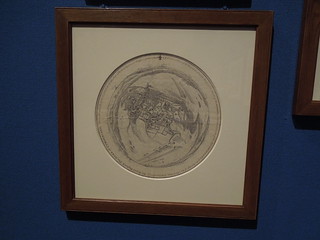
This map is by Schultz from 1745.  Schultz was a draughtsman working for Cumberland who was tasked to map territory and record battles.  In the summer of 1745 Schult climbed the crossing tower of the church at Dieghem, Belgium, and drew this panarama of the surrounding territory showing the incampments of the Amry of the Allies.

Elegant.
14 06 30 RICS (2)