A light-hearted blog about all things geomatic as seen through the filter of Ruth Adams, a chartered surveyor. It won't be comprehensive, it'll be hydro biased but, hey, it may make you smile ;-)
Sunday, 31 October 2010
Navigating in the Arctic - Challenges
An interesting article on the challenges of positioning and navigating in high latitudes. I touched on this earlier this month and I suspect this will be an increasingly discussed subject.
Monday, 25 October 2010
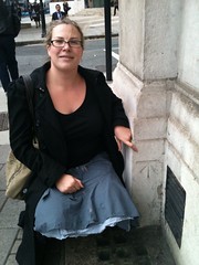
Sightseeing Benchmarks (or rather, BMs rock)
A story of benchmark love...
A surveying friend of mine is a tad obsessed about benchmarks (nothing abnormal about that). His cousin recently made the mistake of asking him what a benchmark was. He explained and pointed out a few at which stage she was hooked. Good woman.
Anyway, she works for a homeless charity. She returned to work enthused about BMs and soon her team were out at lunchtime looking for them. They even searched the online BM database to find more.


When their CE heard about it he instantly thought it would be a great alternative exercise for them and the people their charity helps. It gets everyone up and out walking, chatting, seeing the sights - well, if you count benchmarks as sights.
Who'd ever have thought the humble benchmark would be helping the homeless?
A surveying friend of mine is a tad obsessed about benchmarks (nothing abnormal about that). His cousin recently made the mistake of asking him what a benchmark was. He explained and pointed out a few at which stage she was hooked. Good woman.
Anyway, she works for a homeless charity. She returned to work enthused about BMs and soon her team were out at lunchtime looking for them. They even searched the online BM database to find more.


When their CE heard about it he instantly thought it would be a great alternative exercise for them and the people their charity helps. It gets everyone up and out walking, chatting, seeing the sights - well, if you count benchmarks as sights.
Who'd ever have thought the humble benchmark would be helping the homeless?
Sunday, 17 October 2010
Thursday, 14 October 2010
CPS 98 - Conscientious Objectors Survey America
Enjoyed reading this article about CPS 98 the "odd geodetic survey crew". I'd never thought what a nation would 'do' with conscientous objectors. There were 43,000 in the US and, from what I read, the ones who turned to surveying had a good time. Less so those who 'volunteered' to be human guinea pigs in medical experiments. No thanks. Give me a tent and a theodolite everytime.
Monday, 11 October 2010
The History of the World in 100 Objects
This is an interesting series but I haven't been paying much attention to it. Until now when these latest two episodes were bought to my attention.
Last week we had a North America buckskin map. Transcript is here.
But this week is better, Darwin's chronometer (or, rather, one of the 22 chronometers on HMS BEAGLE). Full transcript is here. I read Longitude with much interest some years ago so this was a good 15 mins of radio listening.
A bit more snooping around has unearthed a Hebrew Astrolabe and a Mexican codex map. It's funny but I didn't find the British Museum at all inspiring when I was there last month - it just goes to show that the story behind the object can make all the difference.
Friday, 8 October 2010
Oceanography Library Goes Digital
OK, a bit behind the news here but worth reporting albeit a few months late. Reported in Marine Data news in June.
"Approximately 100,000 volumes from the Scripps Institution of Oceanography Library, the world’s largest oceanography library, have been digitised and are being made publically accessible as part of a partnership between Google, the University of California and the UC San Diego Libraries."
And here we go - the library itself. Wow, you could virtually lose yourself in here...
Thursday, 7 October 2010
Navigating Up North
This article on the Northwest Passage caught my eye in the Guardian the other week. Quite a balanced report. The accuracy of the charting in Canadian waters is coming under increasing scrutiny as more ships sail in the Arctic. It's a national dilema. Hydrographic surveying is very expensive and governments cannot afford to survey every square mile of their territory. They have to focus their efforts on those areas which are most used. Advice from the Canadian Coastguard is here.
Does 24 cruise ships in 7 months count as heavy use? No. But if one of those runs aground and has a fuel spill which causes $millions to clean up who pays? The government (in the first instance). Risk versus cost. The universal dilemma. Should those ships who use these areas pay for the charting? A nice idea but cost prohibitive I suspect.
The Russians are using imagery to advise on clear routes through the ice. Certainly no replacement for navigational charts (of whatever source data vintage) but anything helps. I suspect forward looking radar are the best bet but even that didn't work for HMS ENDURANCE the other year.
Subscribe to:
Comments (Atom)