A keen-eyed Geographical reader sent me a great article today entitled "I'm a geographer". It is an interview with a sewage engineer who has the goal of being the first person to visit all 6100 surviving OS trig pillars. The paragraph he circled for me was amazing...
"....Some of the trig pillars I visit are still used today in the GPS network. They have signals buried deep into them that help to keep the satellite network functioning".
Well that's the first time I've heard of trig pillars keeping GPS on the road! As Martin wryly pointed out perhaps the trig pillar hunter should stick to sewage engineering. To be fair to the guy I've no idea what he said compared to what was published; but I'm similarly confounded that the Geographical editorial team deemed it intelligent copy. For the first time in my life I've actually sent in a letter to a magazine; I just couldn't let this one pass.
I wonder if those smart trig pillars are Galileo enabled too...?
Wednesday, 18 February 2009
Monday, 16 February 2009
Armagh Planetarium
Briefly visited Armagh's planetarium today. I've been there off and on for 20 years and it has come a long way. We didn't have time to see a show but enjoyed the Astropark and the indoor exhibits. ESA have some good 3D films showing - one on Galileo and one on earth observation satellites. I was amused that the Galileo film suggested that when it comes onstream we'll all be able to navigate and locate ourselves precisely using satellites. Which is more-or-less what we do with GPS; which didn't get a mention funnily enough. But who am I to grumble - it's geo-promotion which I'm all for.
I lingered over the small but sweet OSNI exhibit simply showing 3 eras of mapping. And bought a fun book on space for the kids (well me really )
)
I lingered over the small but sweet OSNI exhibit simply showing 3 eras of mapping. And bought a fun book on space for the kids (well me really
Sunday, 15 February 2009
I'm Still Here
I have a follower of this blog who texts me if I'm quiet too long on this forum. So best get chatting again...
Random news I suppose.
The Marine Management Organisation has announced it is to base itself in Tyneside.
Google Ocean 5.0 was released to headlines around the world (and even Radio 4 in the UK). Google Ocean dives under the sea. Good to see - let's get those survey boats out to get better data.
The Guardian sponsored a debate on 'free our data'. Not surprisingly, only those who were pro it attended.
Snow stopped play for many geomaticians in southern England (no comments please on 'softie southerners, I've heard them).
Satellites collide, and it would just have to be a US and Russian satellite wouldn't it, it so gets the media going.
Will that keep you going for a while?
Random news I suppose.
The Marine Management Organisation has announced it is to base itself in Tyneside.
Google Ocean 5.0 was released to headlines around the world (and even Radio 4 in the UK
The Guardian sponsored a debate on 'free our data'. Not surprisingly, only those who were pro it attended.
Snow stopped play for many geomaticians in southern England (no comments please on 'softie southerners, I've heard them).
Satellites collide, and it would just have to be a US and Russian satellite wouldn't it, it so gets the media going.
Will that keep you going for a while?
Sunday, 1 February 2009
Jammy Don at Large
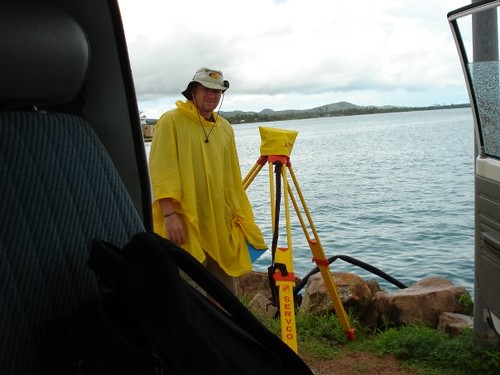
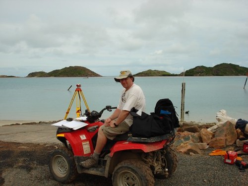
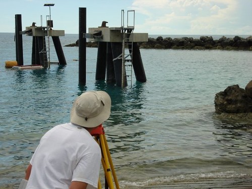
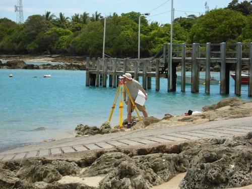
As blogged a few weeks ago, Don was off to the trials and hardships of surveying in the Torres Strait. In his words
"We were conducting 25 hour tidepole-gauge comparisons at our 4 shore stations in the islands for final QC purposes at the end of the survey. This was to ensure we had the same level of agreement we saw during the initial installation back in June 08 and to check that nothing had moved appreciably. The first two islands, Sue and Yam, were a dawdle even if we did have to get wet and clean the poles
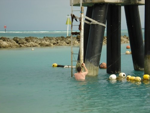
but the last two had no poles (destroyed at Mabuiag; never permanently installed at Badu), which is why we ended up using the levelling staff as a temporary TP
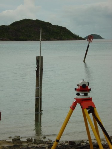
and establishing an approximate sounding datum until we could calculate where the zero actually was then correct to CD. At Mab, we installed the pole then borrowed another levelling staff from a local engineering contractor; at Badu we did our measurements first then because we had the time we did the levelling afterwards. I took some photographs which help explain the various venues, tidepole issues and just generally about the islands and the inhabitants."
The evidence:
And some locals...

"We were conducting 25 hour tidepole-gauge comparisons at our 4 shore stations in the islands for final QC purposes at the end of the survey. This was to ensure we had the same level of agreement we saw during the initial installation back in June 08 and to check that nothing had moved appreciably. The first two islands, Sue and Yam, were a dawdle even if we did have to get wet and clean the poles
but the last two had no poles (destroyed at Mabuiag; never permanently installed at Badu), which is why we ended up using the levelling staff as a temporary TP
and establishing an approximate sounding datum until we could calculate where the zero actually was then correct to CD. At Mab, we installed the pole then borrowed another levelling staff from a local engineering contractor; at Badu we did our measurements first then because we had the time we did the levelling afterwards. I took some photographs which help explain the various venues, tidepole issues and just generally about the islands and the inhabitants."
The evidence:
And some locals...
Subscribe to:
Posts (Atom)