Friday 30 January 2009

What's in a Name?

Our Geomatics Faculty Board, or rather, newly branded Geomatics Professional Group Board, recently had an exchange of e-mails on a meaty Guidance Note. Somewhere along the line someone decided this Guidance Note needed a named author. And the following names ensued. Who said surveyors weren't creative? (OK, need to get out more...rolleyes)

Mr. Theo Dolite
Gunter S Chain
Diane P Level
Edie Emm, our first lady of surveying and her assistant Miss Closure
Mr Mike Roptic and his partner Miss Ally Dade
Tachy O'Meter, the great Irish surveyor - since he retired he now runs an under age drinkers pub, the Sub Tens Bar.

Any more? Go on, you know you want to
wink

Wednesday 28 January 2009

Watching the Marine Bill

The Marine Bill is currently working its way through the House of Lords. It it is in committee and was discussed in the house last Wed, 21 Jan. Insomniacs out there may choose to read the details in Hansard, line by line, blow by blow. Details of its expected progress through Parliament is here. It was back for discussion today so we await with bated breath for the Hansard to be published tomorrow on today's debate today... (my husband thinks I'm terribly sad).

Monday 19 January 2009

A Good Turn

Steve Ritchie has donated his collection of hydrographic books to Newcastle University's department of Geomatics (well, school of Civil Engineering and Geosciences). I am delighted as his collection has found a good, safe home where it'll be appreciated.

I'm a fan of Steve Ritchie's no doubt due to meeting him for the 1st time at Hydro02 in Kiel. After I'd introduced myself he asked if I'd read his book, "No Day Too Long". I apologetically said I hadn't yet whereupon he took my business card and promised to send me one. A signed copy arrived a week later.

And when I became chair of the Geomatics Faculty of RICS he sent me a congratulatory card which was very sweet, especially as I know writing and reading are harder work for him now.

Steve, a living legend.

Friday 9 January 2009

Levelling the Torres Strait

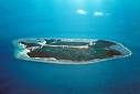
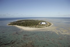
I've a surveying friend who is working in the Torres Strait. Or rather, his company have been working there for a while and when I met him at Hydro08 he was waxing lyrical (or was it hysterical?) about the problems of tidal modelling in the Torres Strait. Now I'm no tidal guru but I know enough from what he said to realise that standard hydro-dynamic tidal modelling was not straight-forward in this area.

So Mr Jammy Don Surveyor has to pop out to the Torres Strait next week to check out the tidal levels. I could think of worse places to visit - he's off to Warraberk, Yam, Mabuaig and Badu.


And where am I next week?

Hemel Hempstead.

Maps in the Sky

I think it's time that I blogged something sensible and constructive here but since any intelligence I do have is sucked out at me at work currently, today's blog offering is from the Cloud Appreciation Society. Check out these maps in the sky!


Sorry just Aus and UK - that's all I could find.