During a recent visit to Amsterdam I was able to discover more about the Dutch vertical datum; from its humble beginnings in the 17th Century through to being the origin point of the European levelling network.
NAP, Normaal Amsterdams Peil, approximates to MSL, Mean Sea Level. However its origins date to the Amsterdam Peil (Amsterdam Level) which was based on the mean level of the IJ, the main waterway of Amsterdam.
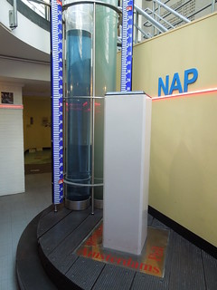
There is an informative visitor's centre in the City Hall which you can visit for the grand sum of 1 Euro. As NAP is lower than the ground floor, the exhibition is in the basement. The top of the brass mound sitting on the white pillar is zero.
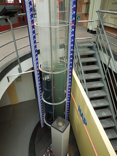
And the water levels indicate the current height of the canals.
The exhibition covers the history of vertical datums in the Netherlands. It included a display of tide poles, which I forgot to photograph, showing how each region initially had its own vertical datum. This was a very common phenomena 350 years ago and improved over the centuries as geodetic networks increased their geographic reach.
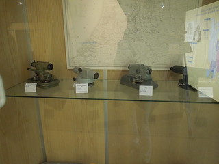
The display of levels below took me back. I remember many hours of levelling the campus at Newcastle University... I left the exhibition knowing that my Euro had been well spent.
I then set off to find the only surviving marker stone of the level of the sea dyke in the 17th Century. But on my way I discovered my first ever Dutch benchmark in Dam Square. The NAP exhibition had a display of these so I knew what to look for.
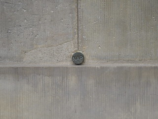
There are apparently 50,000 of these in the Netherlands. So that's only 49,999 to go.
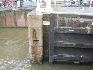
In the pouring rain I then walked to Eenhoornsluis, Unicorn Sluice, Korte Prinsengracht. This level marked the mean high tide during the summer - the height of the sea dyke. For more details there is a good paper here.
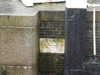
The inscription reads "Sea dyke's height, being nine feet and five inches above City Datum". What an absolute treat to find.
NAP, Normaal Amsterdams Peil, approximates to MSL, Mean Sea Level. However its origins date to the Amsterdam Peil (Amsterdam Level) which was based on the mean level of the IJ, the main waterway of Amsterdam.
There is an informative visitor's centre in the City Hall which you can visit for the grand sum of 1 Euro. As NAP is lower than the ground floor, the exhibition is in the basement. The top of the brass mound sitting on the white pillar is zero.

And the water levels indicate the current height of the canals.

The exhibition covers the history of vertical datums in the Netherlands. It included a display of tide poles, which I forgot to photograph, showing how each region initially had its own vertical datum. This was a very common phenomena 350 years ago and improved over the centuries as geodetic networks increased their geographic reach.
The display of levels below took me back. I remember many hours of levelling the campus at Newcastle University... I left the exhibition knowing that my Euro had been well spent.

I then set off to find the only surviving marker stone of the level of the sea dyke in the 17th Century. But on my way I discovered my first ever Dutch benchmark in Dam Square. The NAP exhibition had a display of these so I knew what to look for.

There are apparently 50,000 of these in the Netherlands. So that's only 49,999 to go.
In the pouring rain I then walked to Eenhoornsluis, Unicorn Sluice, Korte Prinsengracht. This level marked the mean high tide during the summer - the height of the sea dyke. For more details there is a good paper here.

The inscription reads "Sea dyke's height, being nine feet and five inches above City Datum". What an absolute treat to find.

