Visited the RICS yesterday for a Geomatics Exec board meeting. I like these meetings; they are small and relaxed but we canter through a lot of topics. Welcomed a new member, Chris Preston, who works as a surveyor on the railways. He joins Stuart Edwards, a senior lecturer in geomatics at Newcastle upon Tyne University; Ken Hall who runs his own survey company; David Bennett who does likewise, Duncan Moss from the Ordnance Survey and me. So not a bad mix for a room full of land/hydro surveyors - some government, some private practice and academia. Another female or two on the board wouldn't go amiss though.
When I first joined the exec I was the youngest person in the room by 15 years, or so it felt. However the exec membership rotates and I realised yesterday that most of us are a similarish age (OK, OK, I admit I'm getting old) but the days of the geomatics faculty board being run by soon-to-be-retired surveyors has changed.
Anyway, enough of the RICS. Met up with some RN surveyors in the evening for a few drinks. Had some great debates about data formats (particularly in the light of OGC), interoperability of data, research, metadata etc. Food for my soul
Today I visited the Department of Geomatic Engineering at UCL. Boy, do those guys make me feel dense. Spent my time talking about vertical reference surfaces, not only in the UK but globally. Fascinating stuff. Over lunch I asked Marek what he was up to next. One thing he's just picking up is development of a navigation system for a Mars lander - working with NASA/JPL. Marek is the only guy I know that would ever drop that into the conversation and you know he's not taking drugs - that is honestly what his day job is. Amazing!
A light-hearted blog about all things geomatic as seen through the filter of Ruth Adams, a chartered surveyor. It won't be comprehensive, it'll be hydro biased but, hey, it may make you smile ;-)
Friday, 31 August 2007
Wednesday, 29 August 2007
Ordnance Survey in the News Again
Once the Guardian are quick off the mark to report this one. This debate is about a 3D model of London. Licencing issues are the thorn in the side this time. I like CASA's report on it; in particular highlighting the age-old dilemma that Trading Funds face of making a financial return for their government owners compared with giving away the data for the public interest which, taken to its extreme, would bankrupt the OS. I quote CASA,
"Licensing is a minefield and Ordnance Survey particularly are constrained by balancing their public role with their commercial viability in dealing easily with these issues. It is unusual for companies, at least to date, to put 'free' software onto the web that enables users to map their data freely for all to see. Much of the debate therefore turns on what is 'free'."
Agree - a veritable mine field... Interesting though that it seems that only the Guardian are taking this debate on. Aren't the other newspapers/BBC etc interested?
Sunday, 26 August 2007
Strange Maps - Of Brazilians and Gales
I keep an eye on the Strange Maps website. It comes up with some absolute gems at times.
I loved this one about the British Isles! So this is really what we'll look like after a decent gale or two. The more you study it the more weird things you see. I'm currently reading Alice in Wonderland to my kids and I can't decide which is more believable...
Another cracker is the Brazilian theme today. Just how cool is that?!
Back from hols and no more trig pillars to post. I'm sure you're all very relieved ;)
Monday, 20 August 2007
By Special Request
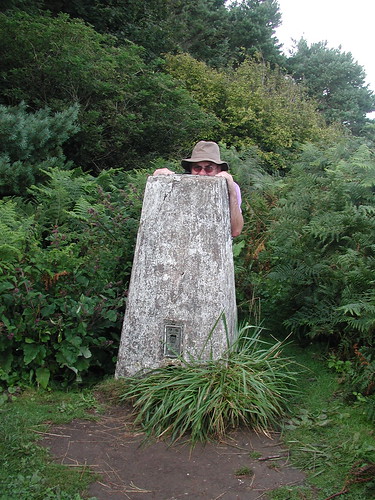
When I saw this photo on my uncle's camera recently I knew it had to be blogged. So here he is on High Peak, just west of Sidmouth, a few weeks ago. It's TP 3799.
That was when we knew how to do sun in Devon.
Sunday, 19 August 2007
Lawrence House Measuring Sticks
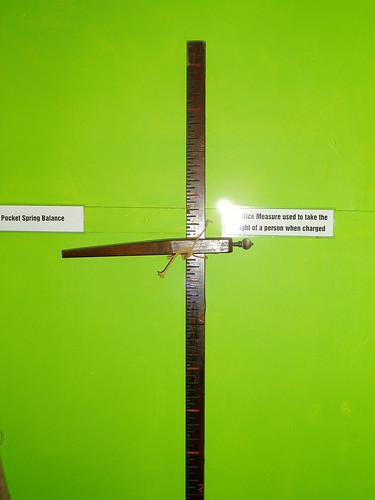
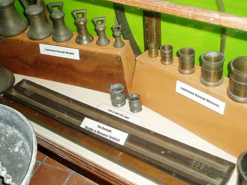
Whilst on holiday wandered into the Lawrence House Museum in Launceston. It's stuffed full of artefacts from Medieval times through to today. I spied a corner full of measuring instruments. I liked the pole for measuring criminals
and the yardstick.
Lots of old maps hung on the walls too: the usual bevy of land ownership plans and parish boundaries. Interesting none-the-less.
and the yardstick.
Lots of old maps hung on the walls too: the usual bevy of land ownership plans and parish boundaries. Interesting none-the-less.
Cornish Trig
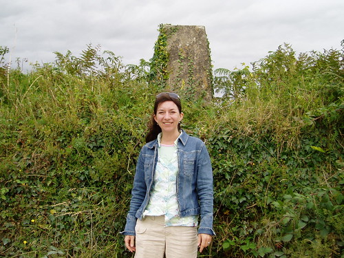
Found one! Came across this pillar, TP 4340, purely by accident enroute to a holiday adventure play thing for the kids.
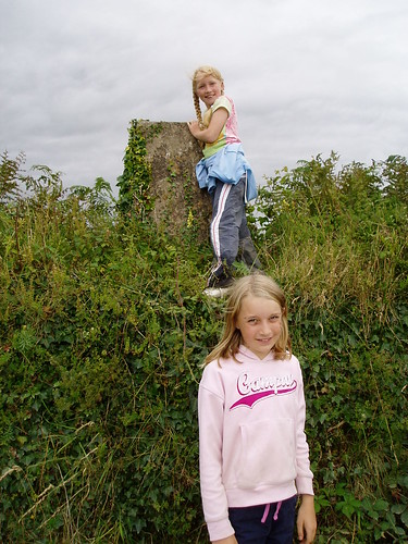
Of course I'm far too old to scramble up brambly banks (!) but my daughter gleefully climbed up.
Another excursion took us to Padstow and I can't resist blogging this...
Of course I'm far too old to scramble up brambly banks (!) but my daughter gleefully climbed up.
Another excursion took us to Padstow and I can't resist blogging this...
Thursday, 9 August 2007
Women in the Labs
One thing I forgot to mention is that I'm a bit of an advocate of women in science. Perhaps no surprise. So I was therefore interested by this article. I love the quote about men being better at spatial abilities than women. SOME women I think. I know men who take you 3 sides of a square when you know the 4th side is so much quicker. Women have a reputation for being lousy at map reading and 3D visualisation but that doesn't mean all women are like that does it? Like, I suppose, is the theory that no man can multitask.
Discuss.
Discuss.
Tuesday, 7 August 2007
How to Tag a Tuna
So how to do you find a fish in the middle of an ocean?
Just following this story through and, as usual, wondered how they knew the lat and long of the fish. If you follow a few leads you discover the page which says the fish are 'precisely located' (love that phrase, esp when you see what's coming next!)...
The tag's processors monitor sunrise and sunset and therefore noon and hence calculate longitude using the tag's internal clock ("very accurately" the article says). Latitude is a bit more tricky and is based on day length. So not the 'precise' levels of positioning that I'm used to - probably within the nearest mile? - but not bad for a fish.
It goes back to what you can do with the materials you have. I was talking with a director yesterday and said surely 'rough-and-ready' was better than nothing at all; as long as you knew how inaccurate the advice you were giving was. Given the choice between no position or an approximate one which would you take?
Sunday, 5 August 2007
SALB
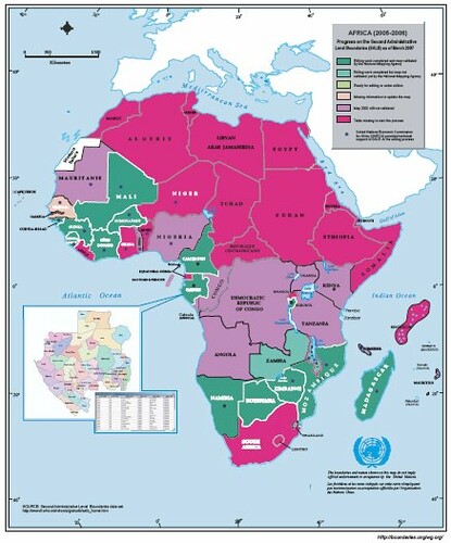
SALB, Secondary Administrative Level Boundaries, is a UN project focusing on a common geographic database to help with land administration. It has an ambitious remit attempting to deliver a global solution. But who can knock the UN for trying? Their July newsletter has a wealth of detail on latest progress. As ever I'm interested in the state of mapping in Africa and it looks pretty woeful on the 1:1 million front.
What can we do?
What can we do?
Thursday, 2 August 2007
Goose
Jason 2 is on its way. I have already used output from Jason 1 and Poseidon 2 for measurement of sea surface height. As satellites are continually improving the accuracy of the data they output and each mission delivers better data, it was with great interest I read about the next Jason mission.
Alongside this is the important Goce (Gravity field and steady-state Ocean Circulation Explorer) mission, which I'd always thought was spelt Goose until I saw it in writing on day. Doh. It will deliver better results than the Grace mission which has been measuring the earth's gravity field since 2002.
It's a busy world up there in space.
Subscribe to:
Posts (Atom)