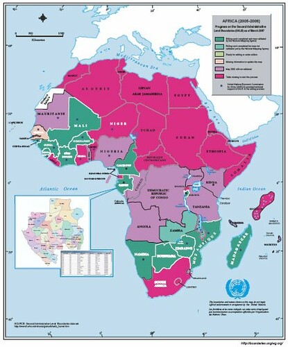
SALB, Secondary Administrative Level Boundaries, is a UN project focusing on a common geographic database to help with land administration. It has an ambitious remit attempting to deliver a global solution. But who can knock the UN for trying? Their
July newsletter has a wealth of detail on latest progress. As ever I'm interested in the state of mapping in Africa and it looks pretty woeful on the 1:1 million front.
What can we do?
No comments:
Post a Comment