Now I like this story.
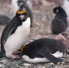
It involves tracking/positioning and my favourite animals. A match made in heaven eh?
A light-hearted blog about all things geomatic as seen through the filter of Ruth Adams, a chartered surveyor. It won't be comprehensive, it'll be hydro biased but, hey, it may make you smile ;-)
Wednesday, 30 December 2009
Monday, 28 December 2009
Pink Parking
I can't quite believe this Parking spaces for the spatially challenged. A shame they assume it's always women who need them.
Sunday, 27 December 2009
Thursday, 24 December 2009
Tuesday, 22 December 2009
Navigating the Ghanaian Way
A friend has pointed out this post so I shall steal his thunder (well, the BBC's) and blog it. As usual, it's not only the article which is interesting but the comments underneath. One particularly ill-formed Timi suggests that in the 21st century just use a GPS. Simple eh? Um, not if the mapping doesn't exist.
Navigation is people finding their way. And in Ghana it appears that people can do that, including the taxi drivers. Sure, a mapping system and GPS would aid immensely but it's chicken and egg really. Who would use a sat nav if there was no base mapping? And who wants to pay for the mapping to be created if people can navigate satisfactorily? OK, the landscape is broader than that, and mapping is for more than navigation, but it's an interesting question and one which should be looked at through Ghanaian and not western eyes.
Sunday, 20 December 2009
Earth Art
I got quite excited recently (just humour me) when I saw posters for the Royal Academy of Arts 'Earth Art' exhibition.
Cool or what?
The exhibition runs until the end of Jan 10. I was scheming a visit to London to visit this until I read the reviews here and here. Perhaps I'll save my geo enthusiasm for something else.
Cool or what?
The exhibition runs until the end of Jan 10. I was scheming a visit to London to visit this until I read the reviews here and here. Perhaps I'll save my geo enthusiasm for something else.
Tuesday, 8 December 2009
Geo Seas
And for today's offering we have Geo Seas an European initiative on an e-portal for geophysical and geological data. Lots of info on infrastructure, metadata and standards. All sounds pretty good for sharing.
And of course, one link leads to another. Sea Data Net has "federated open digital repositories to manage, access and share data, information, products and knowledge originating from oceanographic fleets, new automatic observation systems and space sensors.
"By use of standards for communication and new developments in information technology, in-situ and satellite marine data platforms are providing metadata, data and products as a unique virtual data centre."
Ah, I see the catch now - free data sharing for use of research and education only. Well, not really a catch but it's a way to encourage data sharing without anyone worrying someone is going to make a quick buck out of it.
Monday, 7 December 2009
This One is for You John
My brother-in-law, John, is a geologist. The sort of guy that likes walking around with a wee hammer bashing things. Well this will certainly appeal to him. What a great idea - a subsurface picutre of your world. What a shame it doesn't extend offshore - what's all that about then? Or is it just the mash-up that's been presented by the BBC? Well, if the link worked I'd be able to answer my own question but hey ho, tomorrow's another day...
Friday, 4 December 2009
A Mighty Book
How about this for a big book? Hand bound in leather, gilded edges, silver plated corners; 610 x 469 mm; 576 pages, 154 maps, 800 images; 18.1 kilos; 4 gatefolds extend out over 1.8 metres.
A bargain at £2,400.
Thursday, 3 December 2009
BA 2255
As per last year we had a craft fair at work and one of the categories was, again, creative cakes.
Dear audience, check out British Admiralty chart 2255 of Portland complete with flashing light (south of chart), chocolate break water, referred to WGS84 Datum, compass rose and smartie IALA buoys.
And the best bit? The warning 'not to be used for navigation'.
Dear audience, check out British Admiralty chart 2255 of Portland complete with flashing light (south of chart), chocolate break water, referred to WGS84 Datum, compass rose and smartie IALA buoys.
And the best bit? The warning 'not to be used for navigation'.
Subscribe to:
Posts (Atom)