This map is a 3x enlargement of Simon's engraving of the great seal of the Commonwealth ordered to be made in 1651. On this side seen here it represents, in minature, a map of England (sic) and Ireland, in which the Vyne was named out of compliment to Chaloner Chute who was afterwards Speaker of the House of Commons.
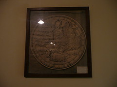
There was another map from 1695, possibly Morden's, but it doesn't look like the Morden's I can find on the internet. Unfortunately the photo didn't come out well as I wasn't allowed to use flash.
In the 'stone room' I came across this lovely piece.
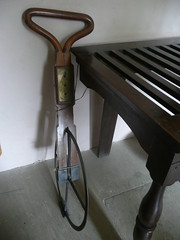
It was crafted by Francis Berry and was obviously used to measure the Vyne estate. I've googled Francis Berry and can't unearth any more about him - perhaps a local Hampshire surveyor?
No comments:
Post a Comment