On Monday I was privileged to visit the Queen's Gallery. One of the cabinets contained a selection of military maps collected by the Duke of Cumberland in the 18th Century. Many of these military maps were in support of the suppression of the 1745-46 Jacobite rising.
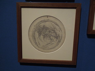
This map is by Schultz from 1745. Schultz was a draughtsman working for Cumberland who was tasked to map territory and record battles. In the summer of 1745 Schult climbed the crossing tower of the church at Dieghem, Belgium, and drew this panarama of the surrounding territory showing the incampments of the Amry of the Allies.
Elegant.
No comments:
Post a Comment