Saturday, 29 November 2014

Goofy Points

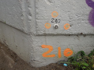
I spent a few days in Frankfurt last week and had zero opportunity for any geo explorations.  However, never one to miss a moment, as we got out the cab at Frankfurt Airport for our journey home I spotted this. A Verm Punkt.
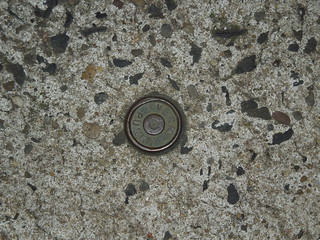
14 11 22_24 Germany (11)
I was with two other chartered surveyors.  The quantity surveyor thought I was nuts to be photographing the pavement, but the geomatics surveyor thought it perfectly normal and to be totally expected in the circumstances.

I had been expecting to find a Mess Punkt, as I had previously in Cologne and Copenhagen.
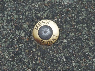
14 10 31 Mess Punkt
On translation Verm came out as "goofing".  Not quite what I was expecting and certainly not what geomatics surveyors do ;-)

However if you translate "verm punkt" you find out that Verm Punkt is actually a contraction of Vermessungspunkt, a measuring point.  And now I've researched a bit more I've realised that "mess punkt" is short for messungspunkt. Which presumably is a contraction of vermessungspunkt.  One word two contractions.  The wonderful world of the German language eh?

Wednesday, 5 November 2014

Wonderful Wonderful Geo Copehagen - The Geomatics Bit

Aside from drooling over the maritime museum, I also found a few observatories in Copenhagen.

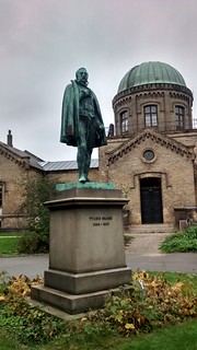
The Botanical Gardens contain Observatory Hill, the highest point of the inner city of Copenhagen.  Which is certainly not much.  But it has an observatory on it and a statue to the astronomer Tycho Brahe.
14 10 31 Botantical gardens too (4)
On Googling info on Tycho Brahe I came across this site, the Scientist Tourist, and realised there is much more to discover, such as Tycho Brahe's 16th Century observatory on Ven, a Swedish Island in the Oresund. I'll pop that on the list for next time.  There's also quite a thing about his false nose which he lost in a duel in the next location I visited. OK, that's not a geo fact whatsoever but you never know when it might come in handy.

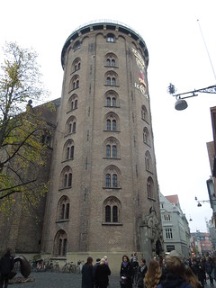
The second observatory I found was up the Rundetaarn.
14 10 31 Runddtaarn (10)
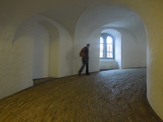
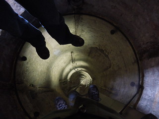
This 17th Century tower has no steps but a 209m long spiral ramp which winds 7.5 times around the hollow core of the tower.  It's only 36m high.  The ramp was built to serve the observatory: pushing astronomical instruments up a slope is an awful lot easier than lifting them up steps.
14 10 31 Runddtaarn (1)
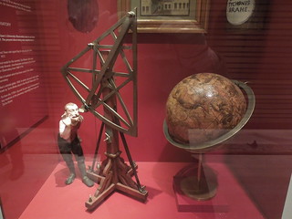
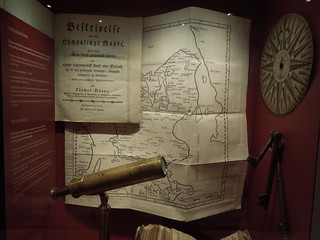
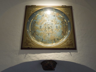
The observatory is the oldest functioning observatory in Europe and some of its old instruments are on display.
14 10 31 Runddtaarn (7)
14 10 31 Runddtaarn (9)
14 10 31 Runddtaarn (4)
I was very pleased to discover that if I stood on the glass floor, approx 25m up the hollow tower, I was standing directly above Denmark's point zero.  It's not everyday that you stand at 0, 0.
14 10 31 Runddtaarn (6)
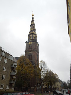
The second tower of the day, sans observatory, was Vor Frelsers Kirke, Church of our Saviour.
14 10 31 Vor Frelsers Kirke (2)
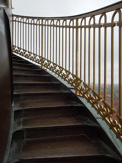
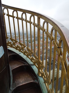
No astro goodies here and no slope, however a great interest factor of a corkscrew staircase which twists initially internally, then externally up the spire.
14 10 31 Vor Frelsers Kirke (7)
The steps get narrower and narrower until they eventually peeter out.
14 10 31 Vor Frelsers Kirke (9)
You can just imagine how wonderful the views were.

And just when I thought it couldn't get any more exciting, we found a mess punkt.  My Copenhagen Odyssey was complete.
14 10 31 Mess Punkt

Wonderful Wonderful Geo Copenhagen - The Maritime Bit

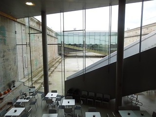
I've just returned from a few days away in Copenhagen.  Number one on my 'to do' list was the M/S Museet for Sofart, the Danish Maritime Museum.  It is based in Helsingor, 50km north of Copenhagen.  From 1915 it was housed in the nearby Kronburg Castle but in 2013 it moved into a new architecturally amazing building set in a dry dock.  The whole museum is underground and I loved the light, steps, slopes and innovative use of the space.
14 10 30 Danish Maritime Museum (30)
The exhibition was pretty darned good too.
14 10 30 Danish Maritime Museum (33)
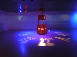
The museum is well themed with innovative use of video and displays.  As ever I was itching for the navigation section.  There were a few interactive displays showing you how sailors calculate latitude and longitude using sextants and chronometers but apart from that there was the standard bevy of glass cases with old instruments in.  I'm sure there must be a creative and fun way to teach navigation but this hasn't quite hit it on the spot.

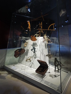
Anyway, a horde of sextants, octants and all things for measuring angles.
14 10 30 Danish Maritime Museum (22)
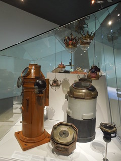
Compasses.
14 10 30 Danish Maritime Museum (25)
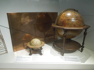
Globes and a copper plate.
14 10 30 Danish Maritime Museum (23)
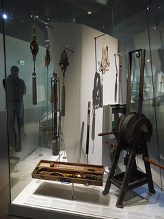
Measuring speed.
14 10 30 Danish Maritime Museum (34)
Depth measurement tools.
14 10 30 Danish Maritime Museum (29)
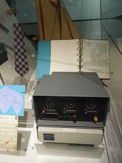
This Decca display brought back memories and made me feel ancient.
14 10 30 Danish Maritime Museum (26)
When I first started work in 1991 Decca was still being used, and the trials and tribulations of sunrise and sunset beset us all.  I never did see a Decca tie worn though.
14 10 30 Danish Maritime Museum (27)
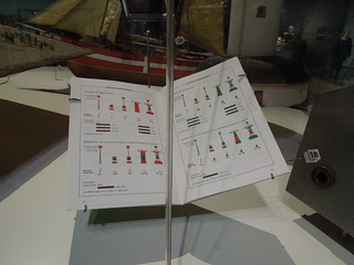
A Danish chart symbology guide.
14 10 30 Danish Maritime Museum (28)
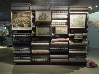
The section on international trade was interesting.  Ranging from the beginnings of organised international trade - tea, china, cloth etc - right through to the huge container ships of today.
14 10 30 Danish Maritime Museum (38)
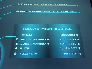
I played a game involving buying, shipping and selling goods around the globe.  Imagine my thrill of coming 4th.  Oh, perhaps only 5 people had played that day?
14 10 30 Danish Maritime Museum (21)
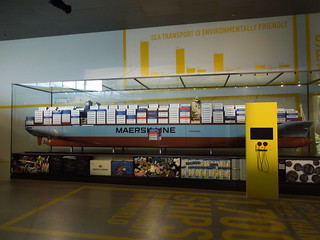
Maersk had a big look in which is not surprising since they are a Danish company.  I think I read that they move 10% of international trade which sounds about right.  They have 600 ships moving 4 million TEU every year between Europe and Asia (let alone the rest of the world).  A TEU is a Twenty Foot Equivalent Unit. It is hard to get one's head around the quantity of goods we are talking about here.
14 10 30 Danish Maritime Museum (40)
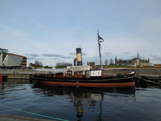
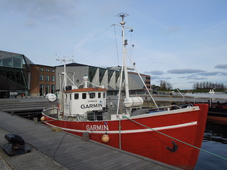
Helsingor itself hosts a well maintained harbour.  The route between the Maritime Museum and the  railway station passes a couple of boats.  One obviously looks like a tourist vessel, but not sure about the Garmin one.  Perhaps used for paying day trippers?
14 10 30 Helsingor (6)
14 10 30 Helsingor (7)
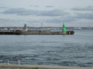
Helsingor harbour marks are well painted.
14 10 30 Helsingor (5)
And I liked the plastic fish.  Better plastic on the quayside than out in the ocean eh?
14 10 30 Helsingor (4)

Sunday, 26 October 2014

Plimsoll Line

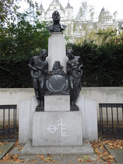
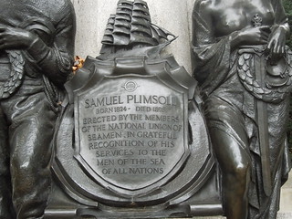
When strolling up the Embankment in London on Thursday I walked past a statue I must have passed 10s of times.  But this time I actually stopped, looked at it and realised it was not a historical war figure (most of them are around there) but Samuel Plimsoll. creator of the Plimsoll line.
14 10 23 Plimsoll (2)
The Plimsoll line, the line indicating maximum load levels, has prevented needless deaths at sea from overloading.  It seems obvious now but in the 19th Century it took him over 5 years before it became law.  It wasn't helped that many parliamentarians at that time were ship owners and deemed his proposal as a profit curbing exercise.   You can read Plimsoll's breach of order in Parliament (otherwise known as a rant - for all the right reasons) in the 1875 Hansard.
14 10 23 Plimsoll (1)
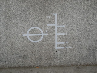
The symbols below are:

TF = Tropical Fresh
F = Fresh
T = Tropical Zone
S = Summer
W = Winter
WNA = Winter North Atlantic
and LR = Lloyds Register
14 10 23 Plimsoll (3)
The lines indicate the legal limit to which a vessel can be loaded for specific water types to safely maintain buoyancy.  Ships float lower in fresh rather than saline water so if they load to the fresh water line and then move into salt water with the same load, the sea level will align with the F and then the S as they float higher.  This classification obviously takes wave hazards into account which is why the least load is for Winter North Atlantic.  Mind you, I'd think Summer South Atlantic - Drakes Passage anyone? - would be pretty hairy.
Sunday, 28 September 2014

Mess Punkt

When in Cologne recently I continued my search of all things geo.  After my Amsterdam travels I knew what a benchmark should look like and, lo and behold, I soon found one.  For sure, most of them were not so elaborately marked, but there are oodles of them.
14 09 25 Cologne (1)
I also learnt a new word - Mess Punkt - a measuring point.  You can just about see the word 'Mess' on the plastic surrounding the small brass stud in the photo.  They also exist as small metal disks on the pavements.  Bizarrely I appear to have forgotten to photograph one.

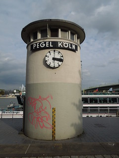
Of great excitement was the tidal tower by the River Rhine.  This initially looks to be a time piece, but the dial only goes up to 10.  Each tick represents a decimetre.  It is showing 3.3m here but the other side showed 3.0 a few minutes earlier and I can't imagine it goes up and down that quickly!
14 09 25 Cologne (12)
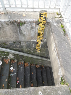
The average depth of the Rhine at Cologne is 3m.  Which, at it turned out, was what it was last Thursday.  This pole shows depths from 6.9m to 8.5m.
14 09 25 Cologne (9)
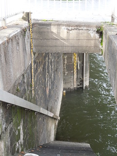
Looking further down the steps there are two more poles.  One from 6.9 to 3.2m, and, just peeping out of the water, is the 0 to 3.2m pole.  Tidal level 3.0m.
14 09 25 Cologne (11)
Low water levels obviously restrict the navigable channel, and docking opportunities for vessels with deep drafts.  At 2.5m depth it gives a 150m wide navigable channel (more info here).  However I suspect the more significant problem is the bridge clearances.  A 2.5m depth gives 9.1m clearance so some of the larger cruise ships appeared to have little spare.

Bearing in mind the Rhine here flooded to over 10m less than 10 years ago (which is 10cm short of the top of the yellow pole on the tide tower) you can see why the Cologne authorities have spent so much on flood protection.  

Sunday, 21 September 2014

Rocky Benchmarks

Some friends of mine have just been to Colorado for some walking in the Rockies.  They sent me a photo of an unusual find they came across whilst on their hike.
14 09 Lora Colorado
Not quite what one would expect 14 000 feet up but perhaps it was next on the cabin's occupant's 'to do' list.

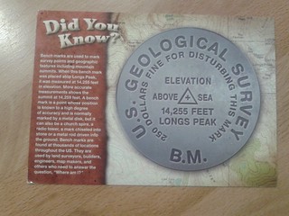
A week or so later this postcard arrived in the post.
14 09 17 Postcard BM
This has to rate as the coolest card I have ever received.  And probably only appreciated by those with supreme geodetic good taste ;-)

Tuesday, 19 August 2014

Normaal Amsterdams Peil - Amsterdam Ordnance Datum

During a recent visit to Amsterdam I was able to discover more about the Dutch vertical datum; from its humble beginnings in the 17th Century through to being the origin point of the European levelling network.

NAP, Normaal Amsterdams Peil, approximates to MSL, Mean Sea Level.  However its origins date to the Amsterdam Peil (Amsterdam Level) which was based on the mean level of the IJ, the main waterway of Amsterdam.

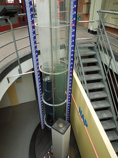
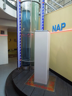
There is an informative visitor's centre in the City Hall which you can visit for the grand sum of 1 Euro.  As NAP is lower than the ground floor, the exhibition is in the basement. The top of the brass mound sitting on the white pillar is zero.
14 08 14 NAP (7)
And the water levels indicate the current height of the canals.
14 08 14 NAP (2)
The exhibition covers the history of vertical datums in the Netherlands.  It included a display of tide poles, which I forgot to photograph, showing how each region initially had its own vertical datum.  This was a very common phenomena 350 years ago and  improved over the centuries as geodetic networks increased their geographic reach.

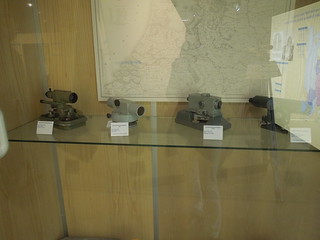
The display of levels below took me back.  I remember many hours of levelling the campus at Newcastle University...  I left the exhibition knowing that my Euro had been well spent.
14 08 14 NAP (5)
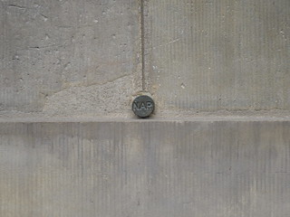
I then set off to find the only surviving marker stone of the level of the sea dyke in the 17th Century.  But on my way I discovered my first ever Dutch benchmark in Dam Square. The NAP exhibition had a display of these so I knew what to look for.
14 08 14 NAP (8)
There are apparently 50,000 of these in the Netherlands.  So that's only 49,999 to go.

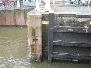
In the pouring rain I then walked to Eenhoornsluis, Unicorn Sluice, Korte Prinsengracht. This level marked the mean high tide during the summer - the height of the sea dyke.  For more details there is a good paper here.
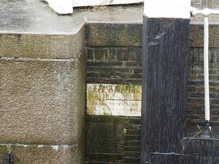
14 08 14 NAP (10)
The inscription reads "Sea dyke's height, being nine feet and five inches above City Datum". What an absolute treat to find.
14 08 14 NAP (9)