I have just returned from a trip to Malindi, Kenya. I was there on business (as usual) supporting a local road that we had surveyed. However, being the geo spotter that I am, I noted that there was an IGS point nearby at an Italian Space Station and it became my mission to find and seek. I've been to both Herstmonceux and Hartebeesthoek so it only seemed right to try to visit this one too.
Our route up to Ngomeni took us 30km or so up the B8. This was 'our' road of which we have surveyed 332km.

Our driver had been with our survey team for the whole project and knew an awful lot about surveying by the time he'd finished. He was giving me a run down, as he drove, re: how our surveyors operated. He found us one of our control points.
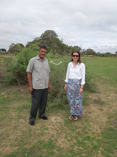
We left the tar road at Mjanaheri and jolted and swayed our way up the gravel, pot-holed road to Ngomeni. By the time we reached the space station, the forecast rain had set in and I experienced the joy of full-on Kenya rainy season. At least it was warm.

Luigi Broglio Space Centre is an Italian run establishment on Kenyan land. We hadn't managed to obtain an invitation before we arrived so had only one option; pitch up and see if they'd let us in. Business cards, hi vis jackets and passports ready we gave it a go.

Security was tight but it was amusing to watch locals turn up and be admitted. They would hold their panga (machete) over their head whilst being scanned for weaponry. A US Marine turned up too - or at least a person in US Marine uniform - which I found a little odd.
After considerable um'ing and ah'ing, and waiting, and trying to stay dry, we were finally admitted. Wonderful.
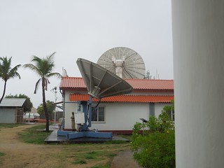
And this was my treasured goal, the IGS point. Actually this is the Galileo one, the GNSS one is just to the left of the shot.
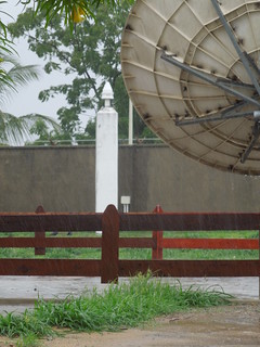
And here they both are: I just like the photo above more as it shows how heavy the rain was.

After a chat with the Italian Director of the centre, we were shown around the site by a Kenyan geodesist.
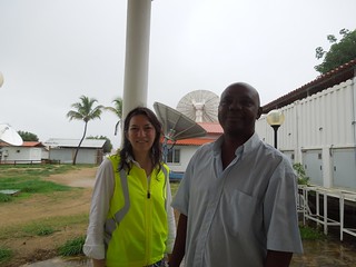
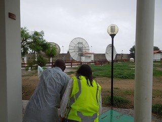
Everything is guarded.
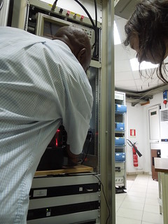
The processing units. All owned by the European Space Agency.
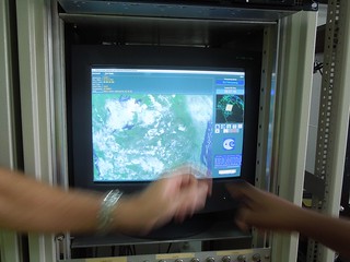
We popped into their remote sensing centre which receives realtime data such as MODIS.
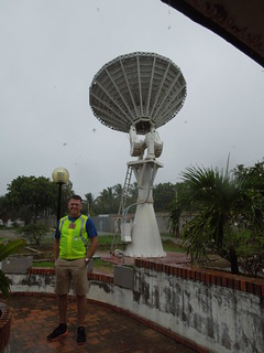
A wet but happy Martin.
My other goal for the day was to visit the Vasco da Gama point. Not only does this have a large, navigation feature on the promontory (somewhat rebuilt and dutifully maintained since Vasco first established it) but there is also a trig pillar.
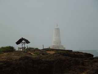
Slightly disconcertingly, we discovered that the key (ahem, only) trig for our network had a shelter next to it to protect those reading the display board from the sun/rain. It also does a mighty fine job of blocking GNSS signals. Doh.
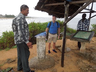
So if there are any tourist officers out there reading my blog (can't think why there would be) please build shelters away from trig pillars as they block the sky. And we surveyors like seeing the sky.
Our route up to Ngomeni took us 30km or so up the B8. This was 'our' road of which we have surveyed 332km.

Our driver had been with our survey team for the whole project and knew an awful lot about surveying by the time he'd finished. He was giving me a run down, as he drove, re: how our surveyors operated. He found us one of our control points.

We left the tar road at Mjanaheri and jolted and swayed our way up the gravel, pot-holed road to Ngomeni. By the time we reached the space station, the forecast rain had set in and I experienced the joy of full-on Kenya rainy season. At least it was warm.

Luigi Broglio Space Centre is an Italian run establishment on Kenyan land. We hadn't managed to obtain an invitation before we arrived so had only one option; pitch up and see if they'd let us in. Business cards, hi vis jackets and passports ready we gave it a go.

Security was tight but it was amusing to watch locals turn up and be admitted. They would hold their panga (machete) over their head whilst being scanned for weaponry. A US Marine turned up too - or at least a person in US Marine uniform - which I found a little odd.
After considerable um'ing and ah'ing, and waiting, and trying to stay dry, we were finally admitted. Wonderful.
And this was my treasured goal, the IGS point. Actually this is the Galileo one, the GNSS one is just to the left of the shot.

And here they both are: I just like the photo above more as it shows how heavy the rain was.

After a chat with the Italian Director of the centre, we were shown around the site by a Kenyan geodesist.


Everything is guarded.

The processing units. All owned by the European Space Agency.

We popped into their remote sensing centre which receives realtime data such as MODIS.

A wet but happy Martin.

My other goal for the day was to visit the Vasco da Gama point. Not only does this have a large, navigation feature on the promontory (somewhat rebuilt and dutifully maintained since Vasco first established it) but there is also a trig pillar.

Slightly disconcertingly, we discovered that the key (ahem, only) trig for our network had a shelter next to it to protect those reading the display board from the sun/rain. It also does a mighty fine job of blocking GNSS signals. Doh.

So if there are any tourist officers out there reading my blog (can't think why there would be) please build shelters away from trig pillars as they block the sky. And we surveyors like seeing the sky.
No comments:
Post a Comment