 What is interesting about it is the fact that unlike 'classical' GNSSs that I was bought up with, this only needs 2 satellites to obtain a fix. Not that this does it by magic. It employs a central ground control station and user terminals with receive and transmit. With only two satellites it is accurate to 100m accuracy but with more satellites the accuracy can be increased to under 20m. Because the ground control station sends and receives data from each receiver the system can only serve up to 150 users simultaneously. The user receivers/transmitters are also bulkier than a GPS receiver and need more power. More information can be found here. [Although this only mentions 4 satellites and I believe they have launched a spare 5th, but not currently in a geostationary orbit].
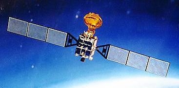
Positions are referred to Beijing 1954 which could be deemed as a limiting factor to expansion as the transformation between Beijing and WGS84 Datum is only defined over China. However I'm sure it wouldn't take much effort to output Beidou coordinates in a different reference frame.
No comments:
Post a Comment