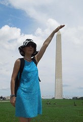
First off, super-sizing trig pillar bagging. It's actually still closed from the earthquake last August. No flush bracket.
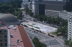
Went up the Old Post Office tower and looked down on Pennsylvania Avenue. Liked the street map of the Federal Triangle area.
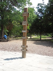
And then today we visited Great Falls Park. As a chokepoint of the Potomac, when the river swells from ice melt or similar it just soars - up to 40/50 m. This sign post marks how high the highest water levels have been over the past 80 years. To put this in perspective, the post is over 40m above current water level.
There is a surveying stone somewhere around here from which they controlled the building of the Patowmack canal - but it was somewhat overgrown so I wasn't able to spot it. The map I was working from was pretty unscaled too so I quickly gave up thinking I could be chasing a nebulous mark all afternoon. Bizarrely my husband was keener to find it than I.
This afternoon saw us at the Udvar-Hazy Centre to plane and spacecraft spot. I have been there before so wasn't gagging for a second visit but the family were keen. And, anyway, it's always nice to see an SRTM radar.

No comments:
Post a Comment